Updates page
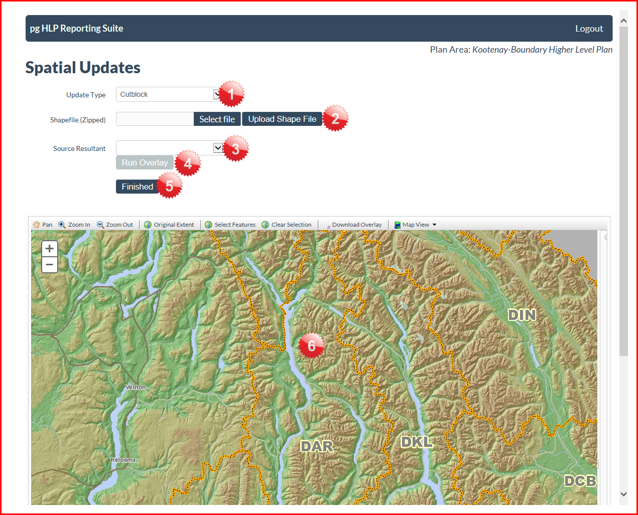
1. Update Type
This dropdown allows the user to select an update for Cutblocks or OGMA's.
2. Shapefile (Zipped)
This allows the user to upload a shapefile that meets the requirements listed in preparing shapefile. It is important the the
shapefile contains the appropriate fields and be zipped in order to work with the reporting suite.
3. Source Resultant
Offers the users the resultant that corresponds to the TSA for which the zipped shapefile overlaps.
4. Run Overlay
This performs the spatial overlay processes in the background.
5. Finished
This brings the user to the database overlay page.
6. Map Area
The map area will display the uploaded shapefile before performing any overlays.
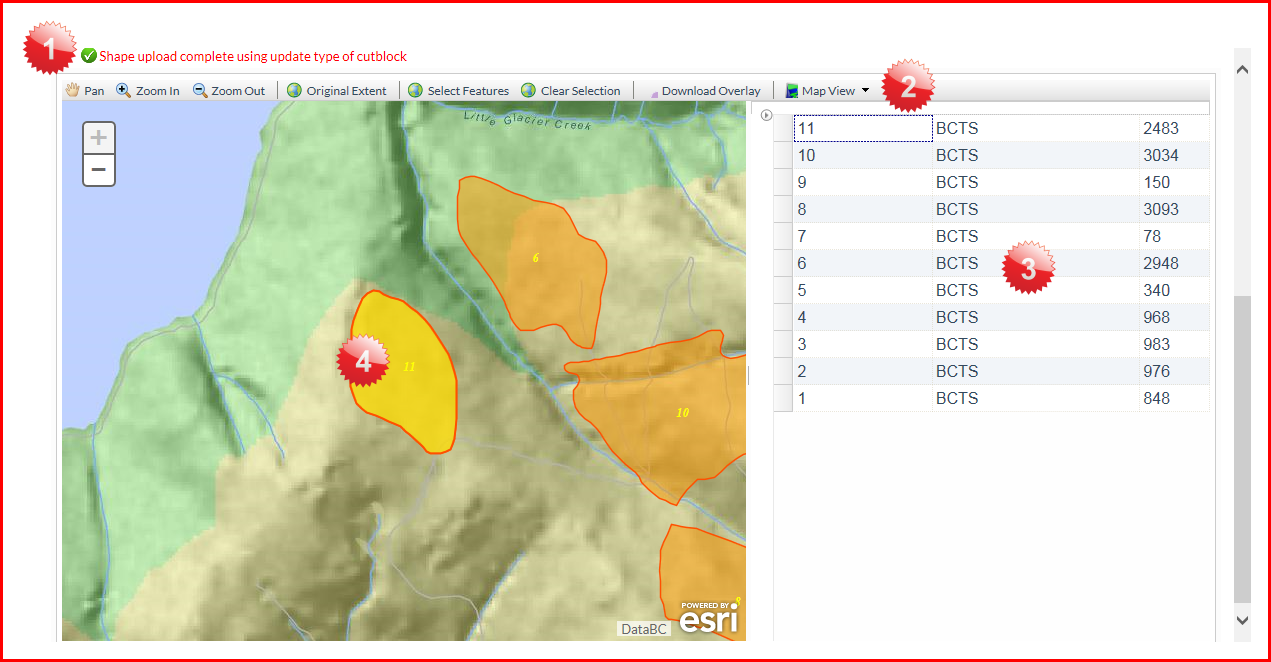
1. Status
Shows whether or not the upload was successful and for which update type
2. Map toolbar
This has some tools that may be useful to the user including 'Download Overlay' after the spatial overlay has been run.
3. Table
Collapsible table showing attribute data from uploaded shapefile.
4. Shapefile polygons
Display of uploaded polygons on base map.
Created with the Personal Edition of HelpNDoc: Free iPhone documentation generator